Region Planner
Region Planner
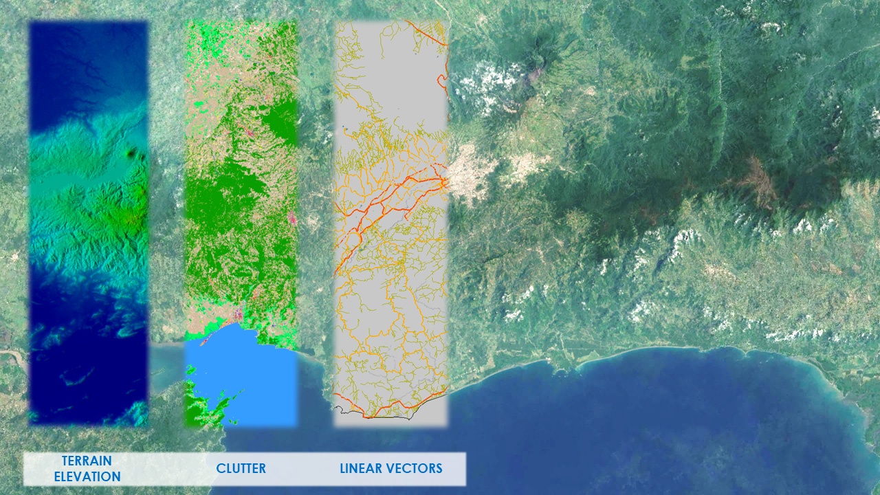
Region Planner medium resolution databases allow you to quickly visualize terrain and clutter over large areas or entire countries. It consists of the following integrated layers: digital terrain model (DTM), clutter, and linear vectors. An orthoimage is also available. Region Planner data sets are designed to be fully integrated with the Urban Planner databases. Application: Bid planning, rural planning.