Listen to audio version of this blog post:
BrightEarth On Demand takes a significant leap forward with version 3.0! More powerful, flexible, and intuitive than ever, this major update introduces groundbreaking features that redefine how spatial data is extracted and utilized. Here’s an overview of the key updates.
BrightEarth is Now Unlimited!
The 50 km² limit is gone! With BrightEarth 3.0, you can now extract data for entire cities, regions, or even countries. This is made possible by parallelized computing through our advanced Amazon Web Services (AWS) cloud infrastructure.
Despite this large‐scale capability, computation times remain impressively reasonable, making BrightEarth a one‐of‐a‐kind platform for the rapid generation of vast territories. It might come at a cost, particularly for extensive areas, but depending on your use case it can still be a great alternative compared to more traditional methods. For example, a 1000km² area can be processed in 2 hours, and dataset augmentation takes just 30 minutes!
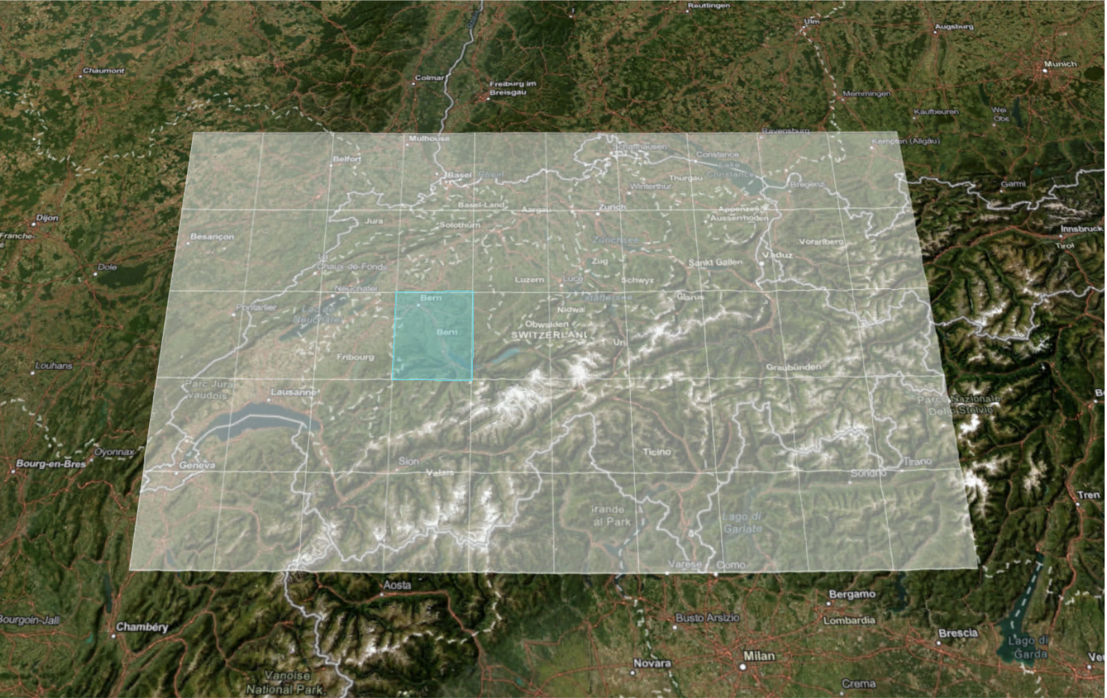
Example of a large area processed in BrightEarth v3.0: a 1500km2 tile in Switzerland.
Flexible Pricing Plans
BrightEarth now offers a credit-based system, tailored to your needs. Choose between:
- Monthly or annual subscriptions: More cost-effective, providing a steady credit flow for continuous analysis.
- Pay-as-you-go: Ideal for occasional needs, allowing you to purchase credits as required.
Payments are accepted via credit card, PayPal, or bank transfer—choose what works best for you! Check out our Pricing Page.

New Pricing Plans
Automatic Registration & Welcome Credits
Signing up is easier than ever with automatic email validation.
To help you explore the platform with no commitment, we offer 10 free credits for new users!
A sample dataset is also available directly in the interface, allowing you to explore BrightEarth before running your own extractions.
Augmented Buildings: Global Coverage Optimized
- BrightEarth’s augmented buildings have reached new levels of precision, covering 68 vernacular architecture zones and 14 bioclimatic zones worldwide.
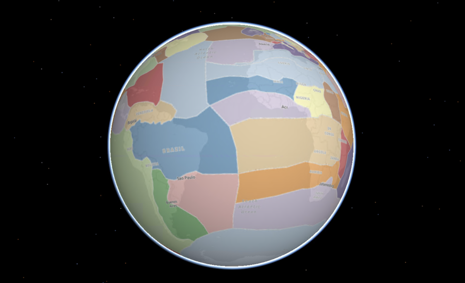
Division of the world into 68 zones of vernacular architecture zones
- Improved normal mapping enhances visual rendering.
- Files are downloadable in 3D Tiles format, with extended compatibility for ArcGIS Pro, Terra Explorer Pro, and Cesium (JS, Ion, Plugin Unreal). More details on Compatibility here.
- QGIS compatibility is in its final development stages, thanks to contributions from the Open Source community.

Example of Architecture zone Andes, South American west coast
Stereoscopy: Better Satellite Image Quality Assessment
BrightEarth 3.0 introduces an enhanced tool for analyzing stereo image pairs. The relative orientation of such images significantly impacts the quality of generated geometry. Now, a quality index base‐to‐height ratio (B/H ratio).
(B/H estimation) is automatically computed, categorizing image pairs as either "Good" or "Poor".
This new indicator helps users select the best image pairs for optimal generation results.
Various Improvements & Bug Fixes
Beyond these significant advancements, BrightEarth 3.0 brings multiple enhancements:
- Improved AI-based detectors for more precise analysis.
- Faster and smoother data exports.
- A refined user interface for a more intuitive experience.
BrightEarth On Demand 3.0 is now available!
Experience the full power of our cloud-based platform to extract and analyze spatial data on an unprecedented scale.